Call: 08045479572
 Send Inquiry
 Send Inquiry
PQWT-S500 automatic mapping water detector for 100
MOQ : 1 Unit
PQWT-S500 automatic mapping water detector for 100 Specification
- Humidity
- 85% RH
- Test Material
- Soil, rock, gravel (subsurface material)
- Operating Temperature
- 0C to 40C
- Sensor
- High-sensitivity electrode probes
- Accuracy
- Resistivity accuracy 2%
- Response Time
- Real-time acquisition (seconds per point)
- Specimen Size
- N/A - field application based
- Test Range
- Maximum 500 meters depth
- Display
- 7-inch touchscreen LCD display
- Temperature
- Recommended operating temperature: 0C to 40C
- Number of Specimens
- Single point or multiple points (profiling & mapping support)
- Power Supply
- Rechargeable lithium battery pack, external power adapter optional
- Type
- Water Detector, Resistivity Meter
- Use
- Geophysical prospecting, hydrological surveying, underground water detection
- Test Medium
- Groundwater, underground water sources
- Operating Voltage
- DC 12V (rechargeable battery)
- Shell Material
- ABS plastic plus aluminum case for portability
- Net Weight
- Approx. 3-4 kg (including accessories and case)
- Pedestal Size
- Standard (as per carrying case dimensions)
- Port Size
- Standard (manufacturer specification not provided)
- Operating Mode
- Automatic Mapping
- Accessory Kit
- Test leads, charger, carry case, reference guide included
- Application Field
- Water prospecting, engineering, disaster survey, irrigation
- Data Storage
- 8GB internal memory, supports USB data export
- User Interface
- Multilingual OS, intuitive GUI
- Battery Life
- Up to 8 hours continuous use
- Dimensions
- Main unit approx. 25 cm x 16 cm x 8 cm
- Software Update
- Supports firmware upgrades
- Data Output Format
- Graphical, tabular, exportable to PC
- Headphones
- Included for noise-reduced operation
- Mapping Function
- Automatic 2D/3D mapping of survey area
- Instrument Class
- IP54 dust & splash resistant
PQWT-S500 automatic mapping water detector for 100 Trade Information
- Minimum Order Quantity
- 1 Unit
- Payment Terms
- Cash in Advance (CID)
- Supply Ability
- 20 Units Per Month
- Delivery Time
- 2-5 Days
- Main Domestic Market
- All India
PQWT-S500 automatic mapping water detector for 100 About
The Elite PQWT-S500 Automatic Mapping Water Detector stands out as a popular, imposing tool famed for its dazzling performance in geophysical prospecting. Take advantage of state-of-the-art automatic 2D/3D mapping, a rugged IP54 build, and an intuitive multilingual interface. With the capacity to probe depths up to 500 meters, this sophisticated device offers 8GB data storage, real-time measurements, and seamless USB export. Its robust ABS and aluminum design ensures portability and enduring reliability-a top choice for water prospecting, engineering, irrigation, and disaster assessment across India. Elevate your operations with PQWT-S500's advanced technology and distinguished results.
Competitive Advantages and Advanced Features
Experience the PQWT-S500's advanced mapping function, which delivers automatic 2D/3D visualization with outstanding resistivity accuracy of 2%. Featuring a 7-inch touchscreen LCD, high-sensitivity probes, and multilingual intuitive user interface, this detector offers real-time data, graphical/tabular outputs, and USB PC export. Use it for groundwater prospecting, hydrological surveys, disaster response, and irrigation planning. Its rechargeable battery provides up to 8 hours of continuous field operation, and all essential accessories are included-making it the top choice for demanding professionals.
Certifications, Supply Details, and Packaging Highlights
Prepare your quotation knowing the PQWT-S500 comes with certified quality assurance for reliable performance and durability. Enjoy swift packing & dispatch, as each unit is securely housed in a sturdy aluminum carry case for market value preservation during transit. High supply ability ensures wholesalers, traders, and suppliers in India can fulfill bulk and retail orders efficiently. Comprehensive packaging includes test leads, headphones, charger, carry case, and reference guide to ensure a complete and seamless user experience.
Competitive Advantages and Advanced Features
Experience the PQWT-S500's advanced mapping function, which delivers automatic 2D/3D visualization with outstanding resistivity accuracy of 2%. Featuring a 7-inch touchscreen LCD, high-sensitivity probes, and multilingual intuitive user interface, this detector offers real-time data, graphical/tabular outputs, and USB PC export. Use it for groundwater prospecting, hydrological surveys, disaster response, and irrigation planning. Its rechargeable battery provides up to 8 hours of continuous field operation, and all essential accessories are included-making it the top choice for demanding professionals.
Certifications, Supply Details, and Packaging Highlights
Prepare your quotation knowing the PQWT-S500 comes with certified quality assurance for reliable performance and durability. Enjoy swift packing & dispatch, as each unit is securely housed in a sturdy aluminum carry case for market value preservation during transit. High supply ability ensures wholesalers, traders, and suppliers in India can fulfill bulk and retail orders efficiently. Comprehensive packaging includes test leads, headphones, charger, carry case, and reference guide to ensure a complete and seamless user experience.
FAQ's of PQWT-S500 automatic mapping water detector for 100:
Q: How does the PQWT-S500 automatic mapping function benefit water prospecting operations?
A: The PQWT-S500's automatic 2D/3D mapping quickly visualizes subsurface water sources, significantly speeding up survey processes while increasing detection accuracy and reducing manual interpretation errors for professionals.Q: What features make the PQWT-S500 suitable for use in engineering and disaster surveying?
A: Its imposing IP54 rating protects against dust and water splashes, while real-time data acquisition and graphical/tabular output make it highly adaptable for engineering projects, emergency assessments, and rugged field environments.Q: When is it optimal to use the PQWT-S500 for underground water detection?
A: The detector is ideal for use in recommended operating temperatures between 0C and 40C, especially when quick, accurate groundwater or geological surveys are required across soil, rock, or gravel terrains.Q: Where can data collected by the PQWT-S500 be exported for further analysis?
A: Collected data stored on the 8GB internal memory can be seamlessly exported to a PC using the USB interface for comprehensive post-survey evaluation or documentation.Q: What process is followed for updating the PQWT-S500's software and firmware?
A: The device supports firmware upgrades, allowing users to take advantage of the latest features and improvements by connecting the detector to a PC and installing updates provided by the manufacturer.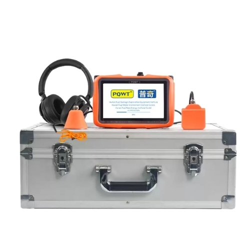
Tell us about your requirement

Price:
Quantity
Select Unit
- 50
- 100
- 200
- 250
- 500
- 1000+
Additional detail
Mobile number
Email

More Products in Water And Leak Detector Category
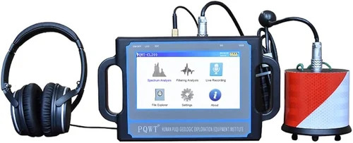
Water Leak Detectors
Minimum Order Quantity : 1 Unit
Net Weight : Approx. 1.2 kg
Pedestal Size : Compact, for handheld use
Test Material : Metal / PVC / Composite pipelines
Use : Water leak detection in pipelines and underground systems
Display : 7 color touchscreen LCD
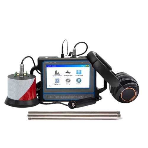
PQWT-CL200 water leak detector
Minimum Order Quantity : 1 Unit
Net Weight : ~2.8 kg
Pedestal Size : Compact, portable design
Test Material : Metal/Plastic pipes
Use : Water leakage detection in pipelines
Display : 7inch color touchscreen LCD
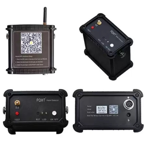
PQWT-M200 automatic mapping mobile water detector for 200m deep
Minimum Order Quantity : 1 Unit
Net Weight : Approx. 1.8 kg
Pedestal Size : Portable/Compact
Test Material : Soil, Rock, Groundwater
Use : Water Detection, Prospecting, Geological Survey
Display : 4.3inch HD Touch LCD Screen
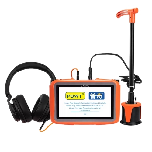
PQWT-L2000 outdoor water leak detector
Minimum Order Quantity : 1 Unit
Net Weight : Approx. 3kg
Pedestal Size : Compact/Portable
Test Material : Metal and Nonmetal Water Pipes
Use : Leak Detection in Outdoor Water Pipes
Display : 7inch Color LCD Touch Screen

Contact Details
EMC Instruments
GST : 09AAHFE9501D1ZL
- A-120, Ground Floor, Sector-69, Transport Nagar,Noida - 201301, Uttar Pradesh, India
- Phone :08045479572
 Send Inquiry
Developed and Managed by Infocom Network Private Limited.
